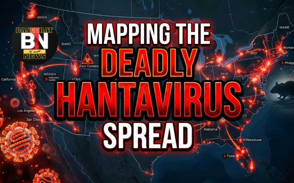
Tracking a Silent Virus Across the World
Hantavirus Map (2026 Edition)
The map began glowing red just after midnight.
Inside a quiet disease surveillance center, scientists stared at computer screens as new warning zones slowly appeared across different parts of the world. Forest regions in South America. Rural communities in North America. Remote mountain areas in Asia. Thousands of miles apart — yet somehow connected by the same invisible threat.
Outside those laboratories, life continued normally.
Families slept peacefully. Campers gathered around fires beneath cold stars. Farmers opened dusty barns at sunrise. Travelers explored isolated cabins hidden deep inside forests. Most had never even heard the word hantavirus.
Introduction — A Quiet Threat Moving Through the Shadows
The forest looked peaceful.
Tall grass moved gently in the wind. Birds sang from hidden branches. Somewhere in the distance, rain clouds rolled across the mountains. To most people, it felt like the perfect wilderness scene — untouched, beautiful, alive.
But beneath that calm surface, something invisible was moving.
Tiny rodents carried a virus unknown to most travelers, campers, and even entire communities. No loud alarms announced its arrival. No dramatic warnings flashed across the sky. Instead, it spread quietly through abandoned cabins, dusty storage rooms, farms, forests, and forgotten corners of cities.
That invisible threat is called hantavirus.
In recent years, the world has watched scientists build detailed outbreak maps to track diseases in real time. During the COVID-19 pandemic, people became familiar with dashboards, heat maps, and infection trackers. But another dangerous virus has slowly returned to scientific headlines in 2026.
This time, researchers are watching hantavirus.
The modern “Hantavirus Map” is more than a chart with colored regions. It has become a living digital warning system — one that tracks rodent populations, climate changes, human infections, travel patterns, and environmental risks across multiple continents.
And the story behind these maps feels almost cinematic.
From the deserts of the American Southwest to the forests of South America and the cold landscapes of Asia, scientists are racing to understand where the virus may appear next. Satellite imaging, climate forecasting, and artificial intelligence now work together to predict possible outbreak zones before infections explode.
But why is hantavirus suddenly gaining attention again in 2026?
Part of the answer lies in climate instability. Floods, droughts, warmer winters, and habitat disruption are pushing rodents into closer contact with humans. Urban expansion is doing the same. Villages once isolated from wildlife are now deeply connected to changing ecosystems.
The result is a growing network of hotspots appearing across global disease-monitoring maps.
For many people, hantavirus still sounds unfamiliar. Yet researchers consider it one of the most dangerous rodent-borne diseases on Earth. Certain strains carry fatality rates that can exceed 30%.
That statistic alone has forced governments, epidemiologists, and health organizations to rethink how disease mapping works in the modern era.
This article explores the full story behind the Hantavirus Map in 2026 — the outbreaks, the science, the fears, the predictions, and the technologies now shaping the future of global disease surveillance.
Because sometimes the most dangerous outbreaks begin in silence.
And sometimes the first warning sign is a map glowing red in the middle of the night.
What Is Hantavirus?
Imagine opening an old cabin after winter.
Dust rises into the air. Sunlight cuts through broken wooden boards. Somewhere nearby, mice have nested for months. Tiny droppings scatter across the floor. To many people, it seems harmless — unpleasant perhaps, but ordinary.
Yet in rare cases, a single breath inside that room can become deadly.
Hantavirus is a group of viruses primarily spread by rodents. Humans usually become infected after inhaling virus particles from rodent urine, saliva, or droppings that have dried into dust.
Unlike airborne viruses that spread easily between humans, most hantavirus strains move from animals to people. That unusual transmission pattern is one reason outbreaks often appear sudden and mysterious.
Different parts of the world experience different forms of the disease.
In North and South America, hantavirus can cause a severe illness called Hantavirus Pulmonary Syndrome (HPS). This form attacks the lungs and breathing system. Patients often experience flu-like symptoms before rapidly developing life-threatening respiratory failure.
In Europe and Asia, another form called Hemorrhagic Fever with Renal Syndrome (HFRS) is more common. This version affects the kidneys and blood vessels.
The frightening part is how normal the early symptoms appear.
At first, many patients believe they have influenza:
- Fever
- Muscle pain
- Fatigue
- Chills
- Headaches
But within days, the illness can suddenly become severe. Breathing becomes difficult. Oxygen levels drop. Intensive care may become necessary almost immediately.
Doctors often describe hantavirus infections as unpredictable and fast-moving.
The virus itself belongs to the Orthohantavirus genus. Different rodent species carry different strains:
- Deer mice in North America
- Cotton rats in parts of the southern United States
- Rice rats in Latin America
- Bank voles in Europe
- Striped field mice in Asia
What makes hantavirus especially dangerous is the way ecosystems influence outbreaks.
When rodent populations explode after heavy rainfall or food abundance, infection risk can rise dramatically. Scientists have repeatedly observed this pattern in outbreak zones.
In many ways, hantavirus acts like an environmental signal.
It reveals changes happening deep inside ecosystems long before humans fully notice them.
That connection between disease and environment is exactly why modern hantavirus maps have become so important in 2026.
Researchers are no longer simply counting infections.
They are mapping weather systems, vegetation growth, migration patterns, and rodent behavior to predict where the next outbreak may emerge.
The map is no longer just about illness.
It is about understanding the planet itself.
History of Hantavirus Outbreaks
The Forgotten Origins
The story of hantavirus stretches back farther than many people realize.
Scientists believe hantaviruses have existed for thousands of years, quietly evolving alongside rodents across forests, plains, mountains, and river valleys.
But for much of history, humans had no name for the disease.
Communities occasionally reported strange fevers linked to rural environments. Some outbreaks appeared after wars. Others followed agricultural expansion or environmental disruption. Yet the true cause remained hidden.
The modern name “hantavirus” originates from the Hantan River region in Korea.
During the Korean War in the early 1950s, thousands of United Nations soldiers developed a mysterious illness. Victims suffered fever, internal bleeding, kidney problems, and shock.
Researchers later identified the responsible pathogen.
That discovery marked one of the first major chapters in hantavirus history.
The 1993 Four Corners Outbreak
One of the most famous hantavirus outbreaks occurred in 1993 in the Four Corners region of the United States, where Arizona, New Mexico, Colorado, and Utah meet.
The outbreak terrified health officials.
Healthy young adults suddenly developed severe breathing problems. Many died rapidly. Doctors struggled to understand what was happening.
The mystery deepened because victims appeared physically strong before infection.
Eventually, investigators traced the disease to deer mice carrying the Sin Nombre virus strain.
What caused the outbreak?
Researchers discovered an environmental chain reaction:
- Heavy rainfall increased vegetation growth
- More vegetation created abundant food for rodents
- Rodent populations exploded
- Human exposure increased dramatically
The Four Corners outbreak transformed public health awareness around hantavirus.
It also changed disease mapping forever.
Scientists realized environmental data could help predict future outbreaks.
South America’s Deadly Strains
During the late 1990s and early 2000s, several South American countries experienced serious hantavirus outbreaks.
Argentina and Chile became major research centers after infections appeared in rural farming regions and forested areas.
Some South American strains showed evidence of limited person-to-person transmission — a deeply concerning discovery for epidemiologists.
The Andes virus became especially feared.
Fatality rates remained high, and outbreaks often emerged in remote communities where medical care was limited.
These events pushed Latin American governments to improve surveillance systems and ecological monitoring.
Asia and Europe’s Long Struggle
While the Americas focused on pulmonary syndrome, Asia and Europe continued battling hemorrhagic fever strains.
China reported thousands of HFRS cases annually for decades.
Russia, Finland, Sweden, Germany, and the Balkans also documented recurring outbreaks linked to vole populations.
In many regions, outbreaks followed seasonal cycles tied to:
- Forest conditions
- Agricultural activity
- Climate patterns
- Rodent breeding cycles
This recurring behavior helped researchers develop the earliest predictive hantavirus maps.
The Digital Mapping Revolution
The COVID-19 era accelerated global disease surveillance technology.
Interactive dashboards became common worldwide. Governments invested heavily in:
- Real-time outbreak monitoring
- Geographic information systems (GIS)
- Satellite tracking
- Artificial intelligence forecasting
By 2026, hantavirus surveillance had entered a completely new phase.
Modern maps now combine:
- Human case reports
- Rodent migration patterns
- Weather anomalies
- Climate risk modeling
- Forest density analysis
- Social media reporting trends
The result is a constantly evolving digital ecosystem designed to detect danger early.
But as mapping technology improved, another problem emerged.
The outbreaks themselves were becoming harder to predict.
The 2026 Hantavirus Outbreak
The year 2026 began quietly.
Then reports started appearing.
A cluster of unexplained respiratory illnesses emerged in rural areas across multiple regions. At first, local health agencies treated them as isolated incidents. But epidemiologists noticed something unusual.
The cases were geographically disconnected.
North America reported increased rodent activity after unstable winter conditions. South American monitoring stations detected rising infection rates among wild rodent populations. Parts of Asia observed abnormal ecological shifts linked to warmer seasonal temperatures.
Slowly, the global hantavirus map began changing color.
Researchers identified multiple high-risk zones appearing simultaneously across different continents.
Unlike earlier outbreaks concentrated in specific regions, the 2026 pattern appeared broader and more environmentally driven.
Climate scientists quickly entered the discussion.
Several studies connected the outbreak patterns to:
- Extreme rainfall cycles
- Flood recovery zones
- Agricultural disruption
- Expanding urban boundaries
- Deforestation activity
In some regions, rodents migrated closer to human settlements after habitat loss.
In others, food abundance triggered sudden population growth.
The public reaction intensified once social media users began sharing outbreak maps online. Images of glowing red hotspots spread rapidly across platforms.
Some posts exaggerated the threat.
Others dismissed it entirely.
Meanwhile, health organizations tried to balance public awareness with panic prevention.
Hospitals in affected areas increased screening protocols for unexplained respiratory illness. Rural communities received warnings about rodent exposure. Campgrounds, storage facilities, and abandoned buildings became major focus points for prevention campaigns.
One of the most important lessons of 2026 was clear:
Disease outbreaks no longer exist in isolation.
Environmental change, technology, public fear, and global communication now interact instantly.
The hantavirus map became more than a scientific tool.
It became part of the public conversation.
How Hantavirus Maps Work
At first glance, a hantavirus map looks simple.
Colored regions. Warning symbols. Infection numbers.
But behind that visual layer exists an enormous network of science, technology, and environmental monitoring.
Modern hantavirus mapping systems combine multiple data streams simultaneously.
Step 1 — Tracking Human Cases
The first layer involves confirmed infections.
Hospitals, laboratories, and public health agencies report suspected and verified hantavirus cases into centralized databases.
Each case includes:
- Geographic location
- Symptoms
- Virus strain
- Exposure history
- Severity level
This information creates the foundation of the map.
Step 2 — Monitoring Rodent Populations
Scientists also monitor rodent activity in high-risk regions.
Field researchers trap rodents, collect samples, and study infection rates among animal populations.
This process helps identify:
- New hotspots
- Population explosions
- Migratory shifts
- Emerging virus strains
In many cases, rodent infection spikes appear before human outbreaks begin.
Step 3 — Climate and Satellite Data
This is where modern disease mapping becomes almost futuristic.
Satellite systems track:
- Vegetation growth
- Rainfall patterns
- Soil moisture
- Temperature shifts
- Flood zones
Why does this matter?
Because environmental conditions directly influence rodent survival and breeding.
Artificial intelligence models then analyze these environmental changes to predict where outbreaks may become more likely.
Step 4 — Predictive Modeling
Researchers now use machine learning systems to forecast risk zones weeks or months in advance.
These models compare:
- Historical outbreaks
- Current weather data
- Human population density
- Ecological trends
The goal is not simply to react to outbreaks.
It is to predict them before they happen.
Step 5 — Public Alert Systems
Some countries now integrate disease maps into public health warning systems.
Citizens may receive alerts about:
- Increased rodent activity
- Infection hotspots
- Safety recommendations
- Travel advisories
In 2026, experts increasingly view disease mapping as one of humanity’s strongest tools against future epidemics.
The map itself has become a kind of early-warning language for the planet.
Countries on the Hantavirus Map
United States
The southwestern United States remains one of the most recognized hantavirus regions in the world.
States like:
- New Mexico
- Arizona
- Colorado
- Utah
continue reporting periodic cases linked to deer mice.
National parks and rural cabins are considered higher-risk environments.
Argentina
Argentina experiences recurring outbreaks linked to the Andes virus.
Some rural communities remain especially vulnerable because of close interaction with wilderness environments.
Researchers in Argentina are among the world’s leading hantavirus experts.
Chile
Chile’s long mountain and forest ecosystems create ideal habitats for rodent carriers.
Public education campaigns there strongly emphasize prevention during camping and outdoor travel.
China
China reports large numbers of hemorrhagic fever cases each year.
The country has invested heavily in surveillance systems and vaccine research targeting specific strains.
Russia
Russia’s massive forest regions support several rodent species linked to hantavirus transmission.
Outbreaks often occur in remote rural areas.
Finland and Scandinavia
Northern Europe experiences periodic outbreaks associated with bank vole populations.
Researchers have closely linked infection spikes to forest ecology and seasonal cycles.
Brazil
Brazil has seen increasing scientific concern regarding environmental disruption and rodent migration.
Rapid land-use change remains a major focus for researchers.
South Korea
The Korean Peninsula holds historical significance in hantavirus research because of early military outbreaks linked to HFRS strains.
Today, surveillance remains highly advanced.
Scientific Research and Predictions
Scientists studying hantavirus in 2026 are asking a disturbing question:
Could climate change reshape the global disease landscape permanently?
Research increasingly suggests the answer may be yes.
Several major studies now connect environmental instability with expanding zoonotic disease risk.
“Hantavirus” belongs to a broader category of illnesses known as zoonotic diseases — infections that jump from animals to humans.
Researchers fear these diseases may become more common as ecosystems destabilize.
Artificial Intelligence and Disease Forecasting
AI systems now analyze enormous environmental datasets in real time.
These systems study:
- Rainfall anomalies
- Vegetation density
- Rodent breeding conditions
- Migration routes
- Human expansion patterns
Some predictive models can identify elevated outbreak risk months before infections appear.
This represents one of the most important breakthroughs in epidemiology.
Genetic Research
Scientists are also sequencing hantavirus strains more aggressively than ever before.
Genomic analysis helps researchers:
- Track viral evolution
- Identify dangerous mutations
- Compare regional strains
- Monitor transmission pathways
Advanced laboratories now share global data faster than at any point in history.
Vaccine Development
Although no universal hantavirus vaccine currently exists worldwide, research continues to expand.
Several experimental vaccines show promise against specific strains.
International collaboration has accelerated significantly since the COVID-19 era.
Public Fear and Social Media Reactions
The internet changes every outbreak story.
In 2026, social media transformed hantavirus from a relatively unknown disease into a trending global discussion almost overnight.
Short videos showing rodents near homes spread rapidly online. Influencers posted dramatic survival stories. Conspiracy theories appeared within days.
Some users claimed civilization was facing “the next pandemic.”
Others mocked the warnings entirely.
This digital divide created major communication challenges for health officials.
Fear spreads faster online than viruses themselves.
The Rise of Viral Maps
One reason hantavirus gained attention involved visual outbreak maps.
Humans react emotionally to maps glowing with danger zones.
A red cluster on a digital dashboard feels immediate and cinematic. It creates urgency even before people fully understand the science.
Media organizations amplified this effect by publishing:
- Animated outbreak trackers
- Interactive risk maps
- Climate danger projections
- Simulation graphics
The result was a powerful mix of information and anxiety.
Psychological Impact
Disease maps affect public psychology in profound ways.
People naturally search for patterns during uncertainty. Maps provide a sense of control — even when the underlying science remains complex.
Researchers now study how digital visualization influences:
- Public trust
- Panic behavior
- Travel decisions
- Consumer habits
- Political responses
The 2026 hantavirus discussions became a case study in modern outbreak communication.
Prevention and Safety Guide
Hantavirus may sound terrifying, but prevention remains highly effective when people understand the risks.
The most important rule is simple:
Avoid exposure to rodent-contaminated environments.
Safe Cleaning Practices
Never sweep or vacuum rodent droppings directly.
Doing so can push infected particles into the air.
Instead:
- Ventilate the area first
- Wear gloves and a mask
- Spray disinfectant on contaminated surfaces
- Wipe carefully using paper towels
- Dispose of waste safely
Protecting Homes and Cabins
Seal small openings where rodents can enter.
Store food securely.
Remove clutter that creates nesting spaces.
Regular inspections help reduce long-term risk.
Camping Safety
Outdoor travelers should:
- Avoid sleeping near rodent nests
- Store food properly
- Use elevated sleeping areas when possible
- Clean campsites carefully
Rural and Agricultural Precautions
Farm workers face elevated exposure risk in some regions.
Protective equipment and proper sanitation remain essential.
Recognizing Symptoms Early
Early medical attention can save lives.
Anyone experiencing:
- Fever
- Muscle pain
- Breathing difficulty
- Severe fatigue
After rodent exposure should seek immediate medical evaluation.
The Future of Disease Mapping
The future of outbreak tracking may look more like science fiction than traditional medicine.
Experts now envision a world where diseases are monitored continuously through interconnected environmental systems.
AI-Powered Global Surveillance
Artificial intelligence may soon predict outbreaks before the first human infection occurs.
Future maps could combine:
- Wildlife monitoring
- Drone surveillance
- Satellite ecosystems
- Climate forecasting
- Real-time hospital reporting
into a single planetary warning network.
Wearable Health Technology
Some researchers believe wearable devices could eventually detect abnormal respiratory patterns associated with emerging illnesses.
That information might feed directly into public health databases.
Smart Cities and Environmental Sensors
Future urban areas may include environmental sensors capable of monitoring:
- Airborne pathogens
- Rodent movement
- Waste systems
- Water contamination
Disease mapping would become part of the daily infrastructure.
Ethical Concerns
But these advances also raise serious questions.
How much surveillance is acceptable?
Who controls global health data?
Can predictive systems accidentally create panic?
The future of disease mapping involves not only technology, but trust.
Fascinating Facts About Hantavirus
1. Hantavirus Can Kill Quickly
Some strains progress from mild symptoms to severe respiratory failure within days.
2. Rodents Usually Do Not Get Sick
The virus often lives harmlessly inside rodent hosts.
3. Climate Directly Influences Outbreaks
Rainfall and vegetation growth can dramatically affect rodent populations.
4. Different Continents Have Different Strains
The Americas primarily face pulmonary syndrome strains, while Europe and Asia often experience kidney-related disease forms.
5. The Virus Was Named After a River
“Hantavirus” comes from the Hantan River area in Korea.
6. Most Human Cases Are Rare
Despite media attention, hantavirus infections remain relatively uncommon compared to many other diseases.
7. Fatality Rates Can Be High
Some strains carry mortality rates exceeding 30%.
8. Disease Maps Use Satellite Technology
Modern outbreak prediction increasingly depends on environmental imaging from space.
9. Rodent Population Booms Matter
Outbreaks often follow ecological events that increase food supplies for rodents.
10. Scientists Study Hantavirus to Predict Future Pandemics
Researchers view zoonotic diseases as major indicators of future global health risks.
Conclusion: Reading the Warning Signs of Nature
The story of the Hantavirus Map is not only about disease.
It is about humanity’s relationship with nature itself.
Across forests, deserts, farms, and cities, invisible ecological systems continue moving around us every day. Rodents migrate. Temperatures shift. Rain patterns change. Forests disappear. Human settlements expand deeper into wildlife habitats.
And sometimes, hidden within those changes, viruses emerge.
The maps scientists build in 2026 are more than medical tools. They are attempts to read the language of ecosystems before disaster unfolds.
Every glowing hotspot tells a story:
- of environmental imbalance,
- of scientific vigilance,
- of public fear,
- and of humanity trying to stay one step ahead of the next outbreak.
Yet there is also hope inside these maps.
Modern technology allows researchers to predict risks faster than ever before. International cooperation has improved dramatically. AI forecasting, satellite monitoring, and genetic research now give public health systems tools unimaginable only decades ago.
The challenge moving forward is balance.
Fear alone cannot protect society. Neither can ignorance.
Awareness, science, environmental responsibility, and preparedness remain the strongest defenses against future outbreaks.
Because somewhere tonight, in a quiet forest cabin or a distant rural valley, another small warning sign may already exist.
And somewhere else, a scientist may already be watching it appear on a map.
Frequently Asked Questions (FAQs)
1. What is hantavirus?
Hantavirus is a rodent-borne virus that can cause severe respiratory or kidney-related illnesses in humans.
2. How do humans catch hantavirus?
Usually, through inhaling particles contaminated by rodent urine, saliva, or droppings.
3. Can hantavirus spread between people?
Most strains do not spread person-to-person, though rare exceptions exist.
4. What animals carry hantavirus?
Primarily rodents such as deer mice, rats, and voles.
5. What are the early symptoms?
Fever, fatigue, muscle pain, headaches, and chills.
6. Why are hantavirus maps important?
They help scientists track outbreaks and predict future risk zones.
7. Is hantavirus deadly?
Yes. Certain strains have high fatality rates.
8. Which countries report the most cases?
China, Argentina, Chile, the United States, and Russia are among the key regions.
9. Can climate change affect outbreaks?
Researchers believe environmental changes strongly influence rodent populations and disease spread.
10. Is there a vaccine?
No universal vaccine exists yet.
11. Can pets spread hantavirus?
Pets are not major carriers, but they may interact with infected rodents.
12. Is hantavirus common?
Human infections are relatively rare.
13. What should campers do for safety?
Avoid rodent exposure and store food securely.
14. Can hantavirus survive in dust?
Yes, under certain conditions.
15. Why do outbreaks happen suddenly?
Environmental changes can rapidly increase rodent populations.
16. What is HPS?
Hantavirus Pulmonary Syndrome — a severe lung infection.
17. What is HFRS?
Hemorrhagic Fever with Renal Syndrome.
18. Are cities at risk?
Urban areas can experience risk if rodent infestations increase.
19. How are outbreaks detected?
Through hospital reporting, laboratory testing, and environmental monitoring.
20. What role does AI play?
AI helps predict outbreak zones using environmental data.
21. Are outbreaks seasonal?
Some regions experience seasonal patterns.
22. How can homes be protected?
Seal entry points and maintain sanitation.
23. Why is rodent control important?
Reducing rodent exposure lowers infection risk.
24. Can children get hantavirus?
Yes, though cases remain uncommon.
25. Are outbreak maps always accurate?
Maps improve constantly but depend on available data.
26. What industries face a higher risk?
Agriculture, forestry, and rural construction.
27. How do scientists test rodents?
Through field sampling and laboratory analysis.
28. Why did social media react strongly in 2026?
Visual outbreak maps spread rapidly online.
29. Could hantavirus cause a global pandemic?
Experts consider widespread pandemic risk lower than airborne viruses, but monitoring remains important.
30. What is the biggest lesson from hantavirus?
Human health and environmental health are deeply connected.
————————————————————————————————————————
The link to the Ginseng benefits is below, just click it.